Geothermal Resource Mapping and Modeling: 3D thermal structure
Evaluating geothermal potential is challenging, we need to elaborate Geology and Geophysics Data to be able to build a realistic subsurface model and calculate the geothermal resource potential. We apply the workflow shown in the diagram (below) to estimate the 3D thermal structure of the target region as the early step of the geothermal exploration. An example Subsurface Temperature Model built in Midyan Basin (NEOM area), is shown below:
.png?sfvrsn=eb202577_1)
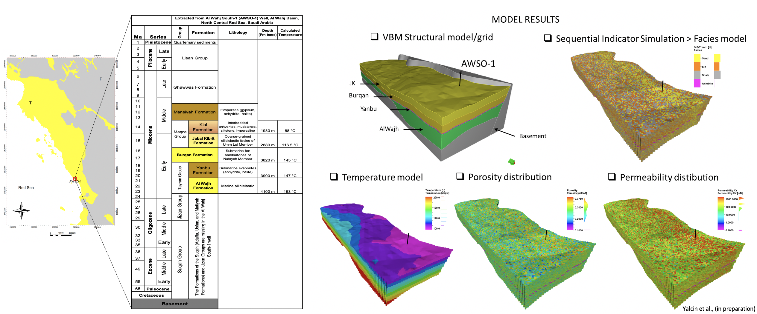
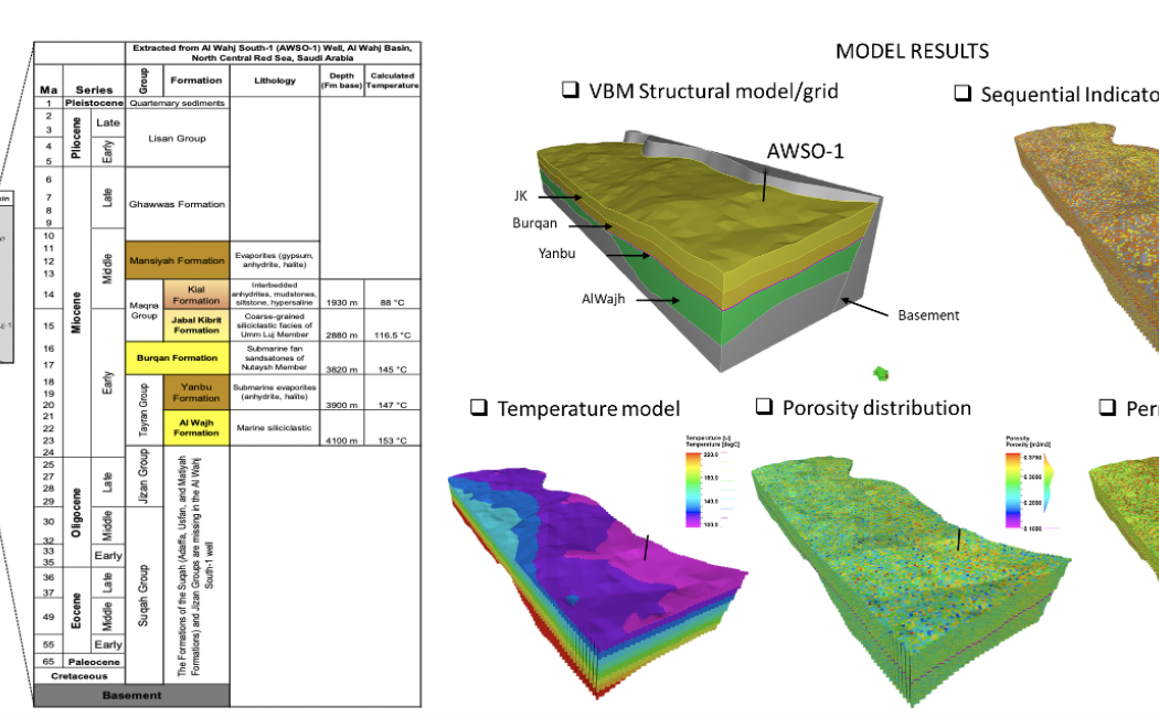
Geothermal Resource Mapping and Modeling: 3D reservoir characterization
We apply an innovative set of solutions to parameterize the sedimentary gross rock volume, facies and distribution of rock-physical parameters such as porosity and permeability with limited data. The example below for the Al-Wajh region is the full field static model of presalt sedimentary rock units to assess the potential for heat mining via CCUS.